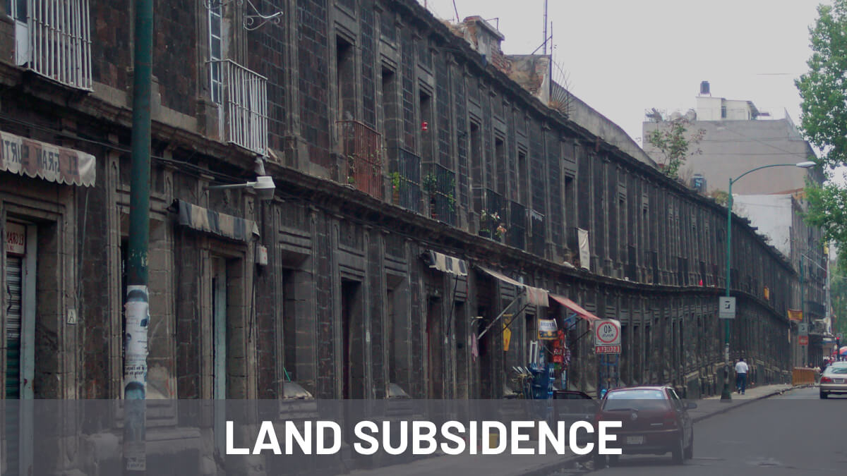
Subsidence affects millions of people around the world. Places such as Jakarta in Indonesia or Mexico City suffer severe and progressive land subsidence processes mainly due to the overexploitation of groundwater. In Spain, the overexploitation of the Guadalentín aquifer (Murcia) generates the highest rate of subsidence in Europe, reaching values of 11cm/year.
Detecting and monitoring subsidence is crucial for understanding its causes, assessing risks, and implementing mitigation measures. In recent years, Interferometric Synthetic Aperture Radar (InSAR) has emerged as a valuable tool for detecting and quantifying subsidence with high precision and accuracy.
Detektia is a technology company specialized in satellite InSAR technology that offers solutions to identify and quantify land subsidence as well as to perform continuous monitoring of it. We may help you monitoring:


If you are a geotechnician, civil engineer, geologist or if you are involved in any phase of the life cycle of a large infrastructure… you are lucky! we can help you. Please, have a look to any of the services linked above. If you prefer, you can easily contact us using a contact form. If you just want to know more about subsidence, we suggest you to continue reading this article.
Throughout this article, we will go into more detail about this threat, delving into the causes and effects that it produces. In addition, we explore the benefits of using InSAR for subsidence detection and quantification, discussing its applications, advantages, and limitations.
What is subsidence?
Subsidence is a phenomenon characterized by the gradual sinking or downward movement of the Earth’s surface. It can be triggered by various factors, such as the dissolution of materials deep underground, excavation of ground tunnels or mining galleries, deep erosion, compaction of soil materials, and tectonic activity.

Both natural forces and human activities can cause ground subsidence. Natural causes include material dissolution, soil creep, underground erosion and tectonic movements. On the other hand, human activities like constructing underground structures, mining activities or excessive exploitation of aquifers can also contribute to subsidence.
Examples of subsidence can be found worldwide. In Mexico City, the excessive pumping of aquifers has resulted in significant land subsidence, causing drainage system issues and impacting historic buildings.
Subsidence in Jakarta is caused by excessive groundwater extraction, construction on weak soil, sediment deposition, tectonic activity, and rising sea levels due to climate change. These factors have led to significant land sinking, posing challenges for the city’s infrastructure and necessitating sustainable solutions.
Closer to Detektia´s headquarters we can also find some noticeable subsidence examples. Over-extraction of water in the Guadalentin valley (Murcia, Spain) has caused the soil to compact and lose volume, leading to noticeable ground sinking. In contrast, the subsidence observed in the La Unión area (Murcia, Spain) can be traced back to historical underground mining activities.
According to UNESCO, subsidence could affect 19% of the world's population by 2040.
Managing subsidence is crucial to avoid potential damage to infrastructure and buildings. Monitoring and assessing subsidence-prone areas are vital, along with implementing measures to mitigate its effects. Proper land-use planning, groundwater management, and engineering solutions are essential to stabilize the ground.
What causes ground subsidence?
Ground subsidence can arise from multiple origins, both natural and anthropogenic and can be grouped into different types based on the factors that trigger it:
- Due to underground dissolution (in salt, gypsum, or carbonate rocks).
- From the construction of underground works or mining tunnels.
- Because of underground erosion.
- From lateral flow (in salt rocks or clays).
- Due to compaction (whether from loading, drainage, vibration, fluid extraction, or hydrocompaction).
- From tectonic activity.
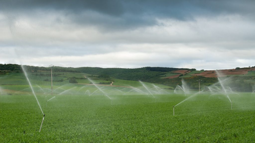
One of the more relevant causes due to the extension of the affected area is groundwater extraction.
When water is excessively pumped from underground aquifers, the vacant spaces in the soil or rock might collapse, leading to the overlying land sinking—a phenomenon witnessed worldwide.
Other processes can also cause subsidence by compaction: soil and sediment might gradually compact and settle over time due to the weight of overburden or internal particle rearrangements. Tectonic processes, like fault movements or sinking tectonic plates, can cause the land to descend slowly over extended durations.
Subsidence caused by underground erosion occurs through a mechanical process of soil particle displacement by groundwater flow. As water moves horizontally through the soil, it mobilizes soil particles, forming channels that can lead to ground collapse.
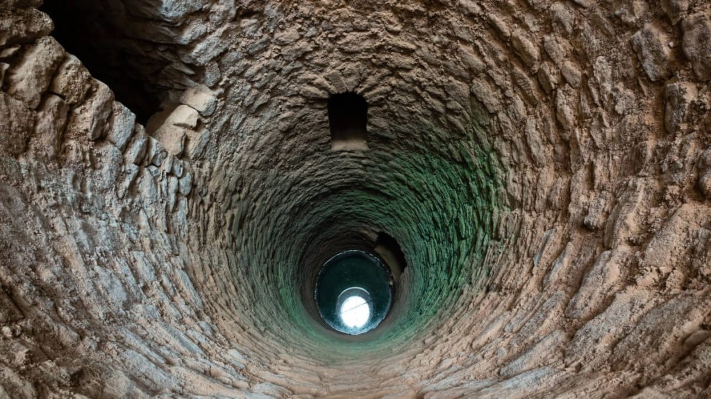
Sodium chloride and other materials such as gypsum and carbonate rocks are soluble in water under certain conditions. This can lead to the formation of large systems of interconnected voids. The deformation and, in extreme cases, collapse of these voids can result in subsidence with a localized character.

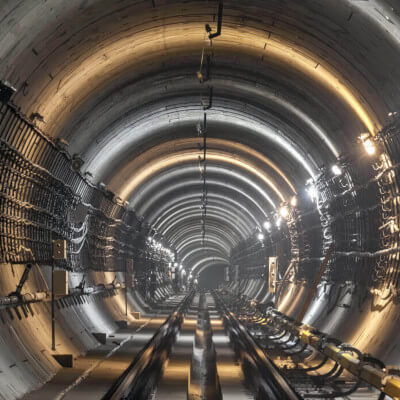
Construction works can lead to ground subsidence, especially sensible when working in underground works in urban environments, where multiple buildings and infrastructures can be affected. Similarly, subterranean mining operations, especially when extracting minerals or other resources, can create voids that, if left unsupported, lead to the overlying land collapsing and descending. This phenomenon is particularly prevalent in regions with extensive mining activities.
These factors represent the main causes of land subsidence. Each region’s unique geological and environmental context determines the specific triggers and mechanisms behind subsidence, requiring customized studies and solutions.
What are the effects of land subsidence?
Land subsidence has far-reaching consequences for our environment, infrastructure, and daily human activities. One of its most visible impacts is on infrastructure: as the ground descends, buildings, roads, bridges, pipelines, and many more assets are affected. Structures may crack, tilt, or experience structural instability, leading not only to high repair costs but also potential safety threats.
Detektia’s Artificial Intelligence layer (working over the DInSAR results) enables an assessment of the structural health evolution of hundreds or thousands of buildings simultaneously. This allows for the identification of vulnerable infrastructures in extensive areas that are impacted by subsidence processes.
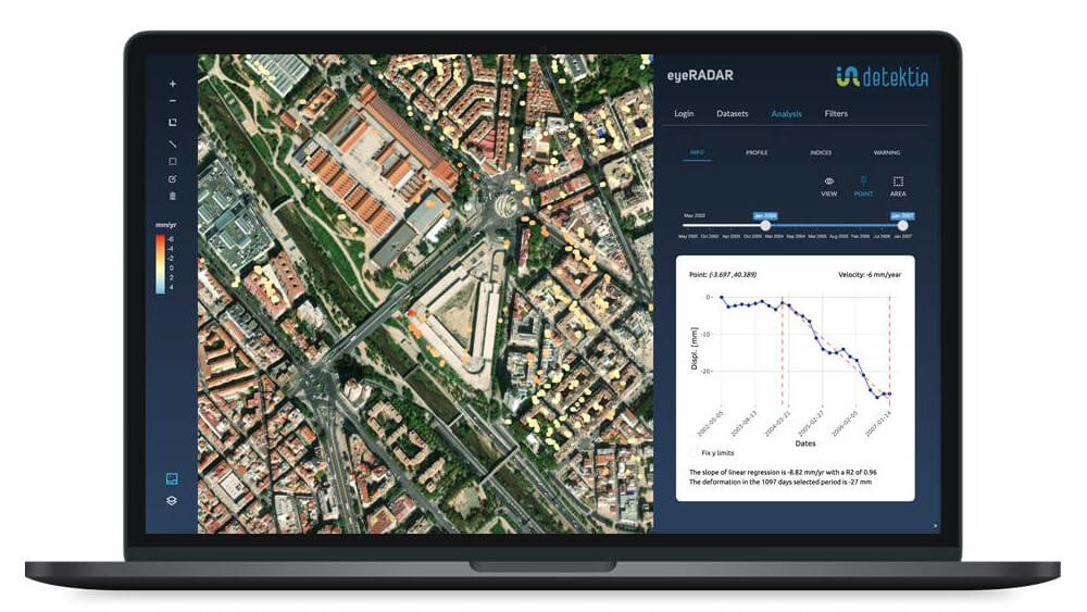
Another major concern arises in the realm of water dynamics. Subsidence can interfere with natural drainage systems, creating depressions that are susceptible to flooding. This accumulation of water can erode land, damage properties, and transform agricultural plots into unusable marshes. Moreover, the disruption to the hydrogeological balance might facilitate saltwater intrusion into freshwater aquifers, jeopardizing our crucial drinking water sources. The integration of piezometric measurements with DInSAR deformation time series allows Detektia to map the evolution of the water table with high spatial and temporal resolution. This information is pivotal for understanding the level of an aquifer’s exploitation and preemptively addressing severe issues like groundwater contamination. Coastal areas face their own set of challenges: subsidence intensifies coastal erosion and, paired with rising sea levels and storm surges, can result in the loss of invaluable coastal ecosystems, habitats, and farmlands.
Furthermore, ecosystems aren’t immune to the ravages of subsidence. As land sinks, it brings shifts in soil conditions, drainage patterns, and vegetation. This can upset the balance for many plant and animal species, with wetlands being especially at risk. These described effects, though extensive, are just a glimpse into the vast repercussions of land subsidence. Each region, based on its unique set of circumstances, will face specific challenges determined by the severity and duration of the subsidence and the inherent vulnerabilities of the area.
Satellite technology provides precise monitoring of subsidence, capturing it with exceptional temporal and spatial detail. By shedding light on these large-scale processes, it enhances our understanding and bolsters decision-making strategies to mitigate adverse effects. In november 2022, European Environment Agency (EEA) released their first ground deformation map based on InSAR technology called European Ground Motion Service (EGMS).
The importance of ground subsidence monitoring and auscultation
Early detection and analysis of ground subsidence are possible through advanced monitoring and auscultation techniques. These methods not only offer a timely warning system to guard against potential infrastructural and environmental damages but also shed light on the primary causes behind subsidence. Whether it’s groundwater extraction, the inherent geological conditions, or human-driven activities, a meticulous examination of the gathered data reveals the chief contributors.
Furthermore, these monitoring procedures are indispensable for determining the rate and magnitude of ground shifts. Such insights dictate the urgency and magnitude of potential repercussions on both built structures and natural ecosystems. In addition to immediate assessment, continuous monitoring paves the way for long-term trend analysis, shedding light on the evolving nature of subsidence, which is vital for informed land-use planning and infrastructural developments. The value of this data is amplified when merged with other geospatial and geological sources such as in-situ, piezometers, satellite optical imagery, topography, GNSS, geological mappings, hydrological statistics and more… This synergy enhances subsidence comprehension and fosters a holistic evaluation of the phenomenon.
Overall, ground subsidence monitoring and auscultation play a crucial role in assessing, managing, and mitigating the impacts of subsidence. They provide valuable information for well-informed and objective decision-making processes, infrastructure planning, and environmental protection.
What are the advantages of InSAR for measuring subsidence?
Traditional methods for monitoring and tracking subsidence based on topographical surveys, on-site sensing, or instrumentation require a significant amount of resources. Monitoring ground subsidence over large areas using only these methods is neither technically nor economically feasible. It is essential to incorporate new data sources to monitor these processes more efficiently and safely.
Satellite radar sensors generate high-quality and high-resolution data across the globe daily. With this vast amount of information, thanks to the InSAR (Interferometric Synthetic Aperture Radar) technology, it’s possible to measure subsidence processes with millimetric precision and high spatial and temporal resolution.

Detektia integrates InSAR technology into the monitoring of subsidence processes, combines InSAR data with other information sources (piezometric networks, GNSS, topography, instrumentation…) and provides consistent metrics and early warnings of millimetric deformations to ground and infrastructure managers.
Real cases of land subsidence
Intensive groundwater exploitation has affected 77 aquifers in Spain, resulting in an annual extraction of around 700 million m3/year, according to Custodio (2002). Most of these cases are concentrated in the southeast region of the country, where many aquifers have been intensively exploited for several decades. It’s worth noting that the Guadalentin aquifer (Spain) is the most well-known since this area experiences the most significant subsidence in Europe. The aquifer affecting the Parque Nacional de Doñana (Spain) is another case well-known in Spain due to its environmental and media repercussions.
Detektia has been working over the past few years on detecting subsidence in places with clear signs of aquifer overexploitation in both Europe and LATAM. In all cases, Detektia has analyzed the effects of the subsidence processes on the buildings and structures in the study area. Some locations of extensive subsidence analysis by Detektia include Mexico City (Mexico), the metropolitan area of Guatemala City (Guatemala), as well as Villena (Spain).
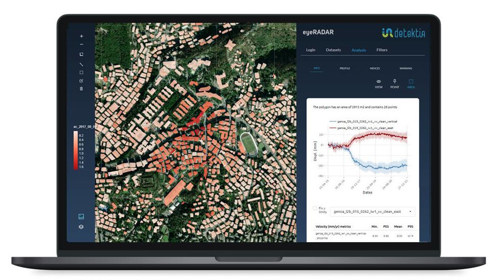
Regarding subsidence due to causes other than groundwater extraction, Detektia has analyzed subsidence caused by tunneling works in Genoa or the one caused after the construction of metro line 7B in Madrid. The extension of metro line 7 runs through the Saline Unit of the tertiary basin of Madrid. The construction works triggered a series of salt dissolution processes that, many years after the inauguration of the line, are still causing serious geotechnical problems in the area.
References
- Cover image was downloaded from: https://commons.wikimedia.org/wiki/File:Casa_de_los_Camilos_o_de_las_calderas_2.JPG
- Other images were downloaded from Adobe Stock Images: https://stock.adobe.com/.
- Tomás, R., Herrera, G., Delgado, J., & Peña, F. (2009). Subsidencia del terreno. Enseñanza de las Ciencias de la Tierra, 17(3), 295-302.
- Vallejo, L. I. G., Ferrer, M., Ortuño, L., & Oteo, C. (2002). Ingeniería geológica. Madrid, Spain:: Pearson Educación.
- Crosetto, M., Castillo, M., & Arbiol, R. (2003). Urban subsidence monitoring using radar interferometry. Photogrammetric Engineering & remote sensing, 69(7), 775-783.
We hope this article has been useful for you! If you have any questions, please do not hesitate to leave a comment below.