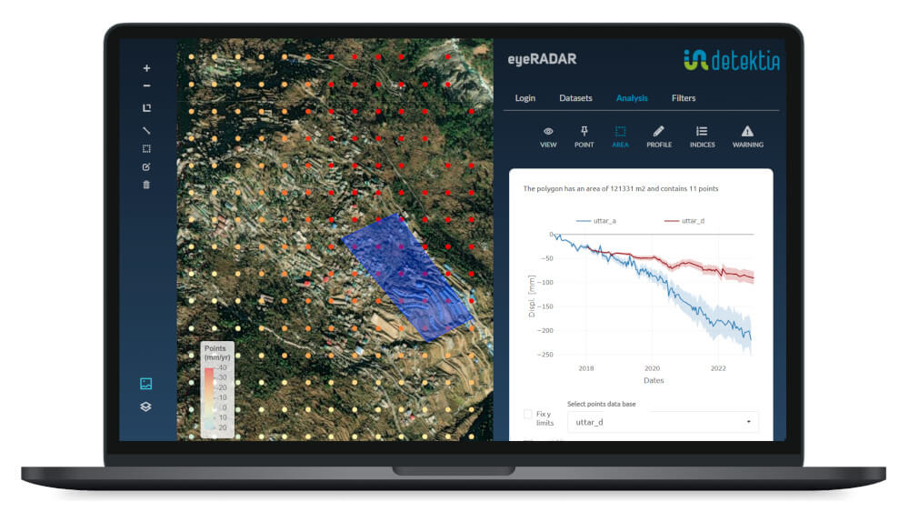
Continuous monitoring and early warning of landslides
- Landslide risk detection
- 100% remote
- No instrumentation or on-site installation required
- Millimeter accurate
A landslide is a large-scale movement of a mass of earth, rock, debris or geologic material that moves downslope. It is characterized by the displacement of large quantities of earth, caused by gravity and other factors such as erosion, soil saturation due to heavy rainfall, or destabilization of the ground by earthquakes or other geologic activities. Landslides can vary in scale, from slow and gradual movements to sudden and catastrophic events, and can cause significant damage to structures, transportation routes and even put human lives at risk.
The integration of DInSAR technology with other sources of information (precipitation, geology, topography…) plays a crucial role in the prevention of landslide-related disasters, especially in large areas where traditional control techniques are neither technically nor economically feasible.
Our clients
Although it is possible to predict slopes that are prone to landslides, predicting the exact timing of a landslide is not always easy due to the numerous factors involved in the formation of these events. The use of instrumentation and measurement sensors used in geotechnical engineering such as inclinometers provide valuable information to measure slope changes and ensure stability. However, these sensors are limited to displaying information from the points where they have been installed and are therefore a limitation for monitoring larger surfaces. It is necessary to incorporate new monitoring systems to obtain more detailed information and foresee possible landslides.
The system that Detektia has developed is complementary to traditional measurement systems.On the day that the probability of landslide in a given area exceeds a certain threshold, the system generates an alert.
Can we help you?
More information
+-What is landslide monitoring?
The ultimate goal of monitoring the terrain to detect and anticipate possible landslides is to ensure the safety of people who may be near the affected surface.
But not only this, knowing the moment in which this type of events can occur helps to take action, if it is still possible to carry out measures to prevent the collapse or at least to have enough time to clear the affected area and act to minimize possible damage to neighboring infrastructures.
+-Landslide forecasting solution based on InSAR technology
Detektia uses InSAR satellite data to monitor large areas and identify early potential ground deformations that could lead to landslides.
InSAR information can help, for example, to know the extent of movement on a slope, to know more precisely if it is a localized or generalized movement, to identify how the magnitude of the movement is distributed along the slope or to contrast if the maximum movement observed with inclinometers is the real maximum.
+-The importance of monitoring the terrain to prevent landslides
Knowing the historical behavior of an area is very important to design and execute any work and this can only be obtained with satellite InSAR information.
This information can lead, for example, to change the layout of a road, saving a lot of money and headaches in the execution and maintenance of the road.
+-New paradigm for landslide and landslide control
A few years ago it was unthinkable to have historical information on the behavior of the terrain. One of the great advantages of InSAR technology is that it allows you to describe the past behavior of an area without the need for instrumentation.
Thanks to InSAR, in addition to the improvement in spatial resolution, we improve temporal resolution and extend the analyzed period.This technology provides us with a double check, as we can contrast the records generated by in-situ sensors and better diagnose the situation of the terrain.