In November 2022, the Copernicus Land Monitoring Service (https://land.copernicus.eu/), managed by the European Environment Agency (EEA, https://www.eea.europa.eu/), published the first map of ground deformations using InSAR technology on a continental scale.
EGMS is unprecedented. It is the first time we have had a service for monitoring deformations on a continental scale, and Europe is the first continent to do so.
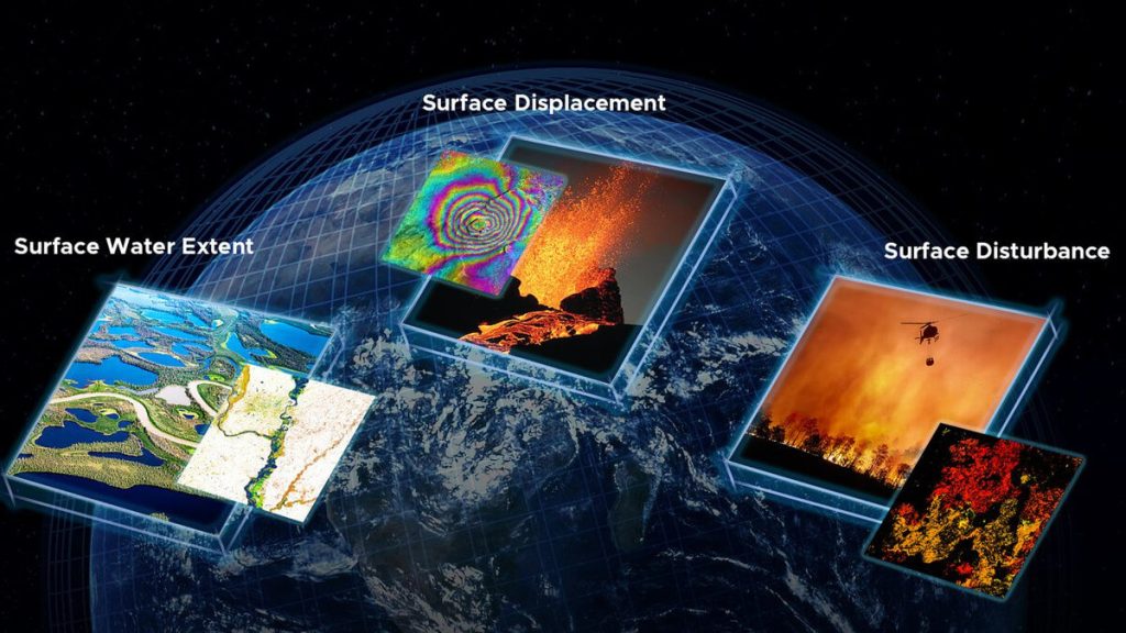
Which data is available on European Ground Motion Service (EGMS)
This service, the European Ground Motion Service (EGMS), provides homogeneous information on ground movements at a continental scale with millimetric precision and annual updates. Currently, deformation data for a six-year series (2015-2021) and a second five-year update (2018-2022) are available.

What is the EGMS and Copernicus Land Monitoring Service project?
The EGMS project is based on the application of Synthetic Aperture Radar Interferometry (InSAR) over long series of satellite radar images. Specifically, it uses information from the Sentinel-1A and Sentinel-1B twin satellite constellation of the European Union’s Copernicus Program (https://www.copernicus.eu/es).
Recently, the Detektia team attended Fringe (https://fringe2023.esa.int/), a leading congress in InSAR technology organized by the European Space Agency. At this congress, there was much talk about the EGMS, and a similar service for the entire USA, part of the (https://www.jpl.nasa.gov/go/opera/about-opera), was presented, which will be available by the end of 2024.
The Sentinel-1 satellites are equipped with a Synthetic Aperture Radar (SAR) operating in C-band. Sentinel-1A was launched on April 3, 2014, and its twin, Sentinel-1B, on April 25, 2016. In December 2021, Sentinel-1B stopped supplying data due to an electronic power supply failure. The launch of a new satellite (Sentinel-1C) is expected in the second half of 2024.
InSAR technology enables the identification of reliable measurement points, generating both the deformation velocity (in mm/year) and the time series of movements with millimetric precision.
Urban or industrial areas and infrastructures of all kinds have characteristics that allow InSAR technology to obtain deformation time series with higher spatial resolution. In vegetated areas, although it is sometimes possible to obtain deformation information, the density of points drops drastically.

In this project, global satellite navigation systems (GNSS) have been used as calibration information for interferometric measurements.
The EGMS distributes three levels of products updated annually:
- The basic product includes time series of deformation in the satellite’s line of sight (ascending and descending geometry). Basic products refer to a local reference point.
- The calibrated product constitutes a higher level of processing than the basic product, as the time series of deformation show absolute movements linked to the GNSS network. That is, this product does not depend on local reference points.
- The Orto product provides movements in vertical and East-West planimetry anchored to the reference geodetic model. Orto products are accessible in a grid with a mesh step of 100 m.
Main features of European Ground Motion Service
The EGMS represents an unprecedented opportunity to analyze a large number of dynamic processes occurring on the Earth’s surface. These processes include geological hazards, human-induced deformations, landslides, ground subsidence, volcanic instability, and many more.
At Detektia, we focus on the application of InSAR technology in the civil engineering sector. Our mission is to integrate satellite InSAR into construction, maintenance, and infrastructure management processes, anticipating the geotechnical behavior of the ground and providing early warnings and structural health metrics to infrastructure managers.
In this context, the EGMS project adds great value, representing a clear opportunity for the civil engineering sector to become familiar with an overwhelming volume of data from a technology that will be key in the coming decades for infrastructure management.
How do we use this service in Detektia?
At Detektia, we have created an inventory of examples and use cases of InSAR technology applications in the civil engineering sector using EGMS data.
To date, we have recorded 87 use cases across Europe, covering more than 3 million points distributed in various categories (urban works, structural health of buildings, slopes, dams, ports, levees, etc.). This compilation constitutes a solid database for analyzing the EGMS project in our sector.

Our database of use cases continues to grow weekly, as we constantly generate new records.
Our inventory of use cases presents three notable aspects:
- It is accessible via API, allowing automatic data retrieval from various tools, whether a web platform, a geographic information system (GIS), a BIM, from Jupyter, or other types of notebooks.
- We generate time series of deformation in vertical and planimetry while maintaining the high spatial resolution that EGMS has in satellite geometries (ascending and descending).
- We incorporate external variables and a post-processing layer. We include variables such as land use, tree cover, slope, orientation, temperature, precipitation, etc., to perform a more comprehensive analysis of deformations. Our Machine Learning post-processing layer facilitates the objective interpretation of the results, effectively identifying where, when, and to what magnitude deformations have occurred.

Contact us if you would like access to our examples and use cases that demonstrate the great value that InSAR technology brings to the civil engineering sector. You can see some of these use cases in our project section, and we will share more in future blog entries.