- January 2015 - December 2021
- Madrid (Spain)
- Vertical, planimetry
- Sentinel-1
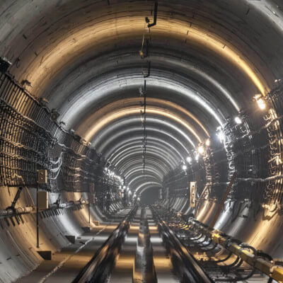
- Tunnels
This study analyzed the deformations of all buildings in a large area surrounding the tunnel path of Madrid Metro line 7B from 2015 to the end of 2022, where significant deformations and impacts were observed in the municipalities of San Fernando de Henares and Coslada, in the Henares Corridor.
The Line 7B of the subway of Madrid was inaugurated in May 2007. Since then, it has been fully or partially closed on multiple occasions (almost 3 years in total out of the 15 it has been in operation).
In addition, dozens of homes have been affected, buildings demolished, and many people evacuated from their homes. The economic cost of rehabilitating buildings, relocating people, and carrying out various interventions to remedy the situation has been very high.
Problems on line 7B of the Madrid Metro
In situations like this, satellite-based InSAR technology can provide highly valuable information.
Objectively identifying and quantifying building-by-building impacts in real time is key to making the best decisions across all areas of action.
Detektia has analyzed deformations and the structural health of buildings in the municipalities of San Fernando de Henares and Coslada across a large area surrounding the tunnel path from 2015 to the end of 2022. During this period, despite more than 8 years having passed since the completion of construction, significant deformations and impacts have been observed in numerous buildings.
The following EyeRADAR screenshot displays a differential settlement metric across hundreds of buildings in San Fernando de Henares. The map highlights in dark red the buildings with the highest values in this differential deformation metric.
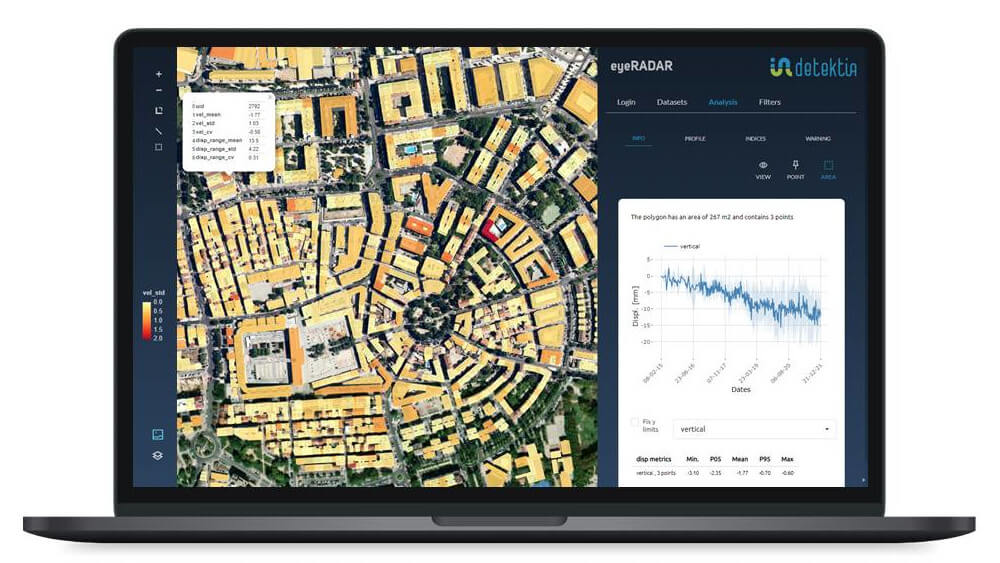
Structural health indexes derived from InSAR results allow each building to be classified according to its level of impact. We have developed indexes that quantify settlements and differential deformations that cause cracks and structural damage in buildings. Some buildings that showed very high values in differential deformation metrics during the analyzed period have already been demolished.
The InSAR-based structural health indexes objectively quantify the condition of all buildings located across a wide area.
Digging deeper into the data, deformation time series reveal the exact moment when the damage began, allowing us to measure with millimeter-level precision the deformations experienced by a specific building.
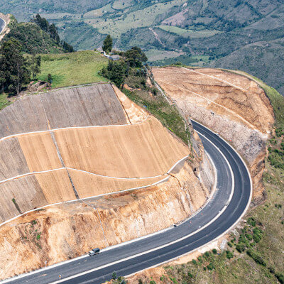
Using InSAR technology and our early warning system, we offer solutions to identify ground deformations and subsidence processes caused by tunneling and subway infrastructures. We also help to monitor other infrastructures such as:


Cracks, displacement, and damage in buildings in the municipality of San Fernando de Henares
In the municipality of San Fernando de Henares, more than 600 homes have been affected by this situation. Some buildings have been evacuated, and some even demolished due to the serious risk of collapse.
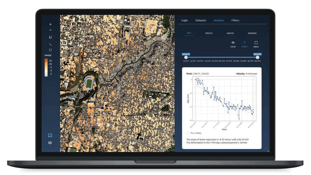
The following image shows the average vertical deformation metric for all buildings in San Fernando de Henares. On the right side of the image, a graph displays the vertical and East-West planimetric deformation time series for a building on La Coruña Street. This graph highlights the dates when an acceleration or trend change in deformation occurred, both in the vertical axis and in planimetry.

Disruptions and closures on line 7B of the Madrid Metro through Coslada
The section of line 7B between Barrio del Puerto and Hospital del Henares stations, which includes Coslada, has been closed since July 2024. Initially, the reopening was expected within seven to nine months, but various delays have pushed this date back. Service is now expected to resume between late August and September 2025.

Since March 2025, the Community of Madrid has begun concrete injection work at various points along line 7B as it passes through Coslada. These preventive works aim to stabilize and waterproof the tunnel to ensure the safety of the infrastructure and nearby homes.
As in San Fernando de Henares, we have analyzed more than 40,000 deformation time series from 2019 to 2023 generated using InSAR technology in the municipality of Coslada. An initial quick analysis shows that the magnitude and extent of the deformations are smaller than those observed in San Fernando de Henares during the same period.

The structural health indexes generated for buildings in the municipality of Coslada allow us to track the evolution of deformation building by building across the entire area.
Given that it is neither technically nor economically feasible to instrument every building and infrastructure in a whole municipality, InSAR technology stands out as a unique tool for decision-making in this type of situation.

InSAR technology allows us to obtain a clear view of the areas affected by the tunneling works.
Do you think InSAR technology could help you monitor your infrastructure, detect ground movements, access historical data, or pinpoint the exact moment when damage occurred? Contact us by clicking here.