
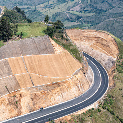
In this post we would like to take a closer look at the use of measuring instrumentation and sensors in the geotechnical engineering sector. More specifically, in the inclinometers.
Inclinometers are a fundamental piece to measure deformations and to guarantee the safety and success of any geotechnical application. In this article we show you all the details of this instrument as well as its use in combination with satellite information.
We provide solutions based on InSAR technology combined with inclinometers. This may help you monitoring:


If you are interested in combining the use of inclinometers with InSAR you may be interested on above contents. If you have more specific questions, please do not hesitate to contact us, we will get back to you as soon as possible.
If you just want to learn more about the use of inclinometers and their importance in the geotechnical engineering sector, we suggest you to continue reading this article.
What is an Inclinometer? Geotechnical engineering
Inclinometers are high-precision tools used in geotechnical engineering to monitor horizontal ground deformations both on the surface and at depth. They are installed vertically from the ground surface and can continuously measure changes in inclination in two specific directions along the entire length of the instrument.

Their operation is based on measuring the change in inclination of a tube inserted into a borehole in the ground. This measurement allows the calculation of the distribution, depth, direction, and magnitude of lateral ground movements.
Inclinometers help in the control and monitoring of horizontal ground deformations both on the surface and at depth.
These devices are crucial for evaluating the stability of slopes and hillsides, underground and surface structures, as well as for monitoring construction projects and preventing risks associated with ground movements. Their high precision and ability to provide continuous data make them indispensable tools in the field of geotechnics.
What are the components of inclinometers? Learn about the parts of an Inclinometer
An inclinometer system consists of four main elements described below:
- Guide tube or inclinometer casing
- Measuring system or inclinometer probe
- Reading unit or data logger
- Cable or connection.
These are the basic parts of an inclinometer, although the specific configuration may vary according to the design and application of the particular inclinometer.
Let’s define each component more in depth!
Guide tube
The guide tube or inclinometer casing is the main component of the inclinometer and is installed vertically in a borehole. It allows access to the probe, deforms with the ground or structure it is embedded in, and controls the orientation of the probe during readings.
The guide tube is considered one of the most important parts of an inclinometer. Its purpose is to facilitate access to the probe and to control its orientation during the measurement.
The diameter of the inclinometer guide tube significantly impacts its durability and performance over time. Eventual deformation of the tube could result in internal blockage.
Generally, guide tubes with larger diameters tend to offer a longer lifespan and are preferable for most applications. However, it is important to note that the diameter of the guide tube is limited by the diameter of the borehole in which it will be installed. Sometimes, due to space restrictions or specific site requirements, it may be necessary to use guide tubes with smaller diameters. In such cases, it is essential to carefully assess the installation needs and select the most appropriate guide tube to ensure effective monitoring and satisfactory durability of the inclinometer system.
The diameter of the guide tube is critical. Inclinometers with a larger diameter tube are more durable and reliable.
The most common diameters for inclinometer guide tubes range from 5 to 15 centimeters.
Guide tubes with small diameter
Smaller diameters, between 5 and 7.5 centimeters, can be used in situations where space is limited or where minimal ground invasion is required.
Guide tubes with big diameter
On the other hand, larger diameters, around 10 to 15 centimeters, are typically selected for applications seeking greater durability and resistance to deformation, especially in areas expecting significant ground movements or where long-term monitoring is planned.
The choice of the appropriate diameter will depend on the specific site conditions and project requirements, as well as considerations such as the required measurement precision, available space limitations, or specific manufacturer specifications of the inclinometer.
Inclinometer probe
The measuring system or inclinometer probe varies according to the type of inclinometer but generally includes a device that records changes in the inclination of the guide tube. It can be a vibrating wire sensor, an electronic sensor, or a pendulum, depending on the inclinometer’s design.
Data logger
The reading unit or data logger is the device where inclination measurements are displayed or recorded. It can be a portable unit connected to the inclinometer or a more sophisticated data logging system.
Cable or connection
In inclinometers that require electrical power or data communication, a cable or connection is used to connect the measuring system to the reading unit or data logger.
Installation and Operation
After completing the drilling, the inclinometer casing is installed, considering the desired orientation of the grooves defining the two axes of deformation measurement. It is common to align these parallel to the slope for better movement detection.
The installation of an inclinometer requires detailed site knowledge.
For optimal results, the inclinometer should be embedded to an adequate depth in firm ground, preferably below the potentially sliding surface. This requires detailed site knowledge. Otherwise, a sufficiently generous length of installation is recommended.

Once the casing is in place within the borehole, the annular space between the ground (or PVC borehole casing) and the inclinometer casing is grouted. To ensure optimal results, grouting should be done from the bottom of the borehole to the surface, using the drill machine’s pump and a tube to introduce the grout and expel air. Complete setting can take about 24 hours. It is also recommended to fill the borehole well with cement or excavate around the borehole mouth to ensure a firm structure when filled with cement.
To understand ground movements, an initial reading campaign is conducted after the casing installation. These initial readings establish the reference point for subsequent displacements. Reading campaigns involve taking a reading every 50 cm or every meter along the entire depth of the tube. The sensor measures inclination in two perpendicular axes, thus revealing horizontal ground displacements.
Depending on the magnitude of inclinations to be measured, sensors of different ranges are available, increasing the resolution and accuracy of the device proportionally to the decrease in its range.
Below is an example of a typical inclinometer result. We see two accumulated deformation graphs, each corresponding to a different measurement axis, axis A and its perpendicular axis B.
In the example, measurements taken on four different dates are shown. For each date and depth, the accumulated deformation since the start of measurements is displayed. The deformation on axis A has a much greater magnitude.

Applications. What are inclinometers used for?
Inclinometers are crucial devices in various engineering applications, providing essential information on the inclination and orientation of structures such as excavation walls, dams, tunnels, or buildings. They are also used to measure ground or natural slope inclinations.
Main applications of inclinometers:
- Slope and Hillside Stability Monitoring: Inclinometers measure changes in the inclination of natural slopes or excavated structures, detecting potential movements indicating a risk of sliding or collapse.
- Settlement Monitoring in Structures: Inclinometers can be installed in structures like buildings, dams, or bridges to monitor inclination changes, indicating differential settlement and aiding in stability assessment.
- Tunnel Deformation Monitoring: In tunnel construction and operation, inclinometers monitor tunnel wall deformations, crucial for ensuring the structure’s safety and stability throughout its life.

Types of Inclinometers
There are several types of inclinometers, including:
- Vibrating Wire Inclinometers: These inclinometers use a vibrating wire sensor that detects inclination based on changes in the vibration frequency of a tensioned wire. They are accurate and suitable for long-term monitoring applications.
- Electronic Inclinometers: These devices use electronic sensors, such as accelerometers or gyroscopes, to measure inclination. They are more compact and can provide real-time measurements, making them useful for applications requiring a quick response.
- Pendulum Inclinometers: This type of inclinometer uses gravity to determine inclination. They consist of a suspended pendulum that moves in response to changes in inclination, with a reading system that records the angle of inclination.
Each type has its advantages and disadvantages, and the appropriate choice depends on the specific application needs and site conditions. In general, inclinometers are valuable tools in geotechnical engineering for monitoring and controlling the stability of structures and terrains.
Integrating Inclinometers with InSAR
Do you know InSAR technology? It can be used to measure ground deformations with extreme precision. InSAR imagery is taken from satellites orbiting hundreds of kilometers high up in the sky.
Is it possible to combine the use of inclinometers with InSAR imagery? Yes, it is! If you are interested about it, just contact us!
Complementing inclinometers with InSAR deformation point clouds offers significant advantages. Inclinometers provide detailed and precise measurements both on the surface and at depth at specific installation points, while InSAR deformation point clouds offer broad coverage and a general perspective of surface deformations. Combining both data sources provides a more comprehensive picture of ground deformation at different scales.
Combining the use of inclinometers with InSAR deformation point clouds is possible and offers great advantages over in-situ measurement. If you are interested on this solution we may help you, just get in touch!
In following image, we see how InSAR complements the measurements taken by an inclinometer on an active slope in the Pyrenees. The inclinometer measured specific point movements, but there were uncertainties about the extent of the displacement. InSAR made it possible to precisely delineate the active area by analyzing how the magnitude of movement varies along the slope. Moreover, the comparison between the inclinometer records and InSAR data was nearly perfect. This double-check also provides significant value for the decision-maker.

The following example shows InSAR results over an active slope in La Rioja, Spain. InSAR data describe surface movements with high spatial resolution, revealing the active area’s dimension and deformation velocity distribution.
This information is crucial for designing the number and placement of inclinometers if instrumentation is required.

InSAR technology enables large-scale continuous ground deformation monitoring over time without the need for on-site instrumentation or installations. Combining inclinometer data with InSAR data allows for identifying long-term deformation trends and sudden events requiring immediate attention. This capability enhances decision-making in instrumentation design, forecasting, and risk mitigation associated with ground movements.
Furthermore, integrating inclinometer and InSAR data allows cross-validation of results obtained by both methods, improving measurement reliability and accuracy by providing multiple independent data sources supporting conclusions on ground deformation.
In summary, complementing inclinometer information with InSAR deformation point clouds offers a more complete, detailed, and reliable view of ground deformation, resulting in better understanding and management of geotechnical risks.
Attributions and credits
Some of the images used in this post haven been downloaed from freepik:
- https://www.freepik.es/foto-gratis/maquinaria-pesada-cantera_7303357.htm#fromView=search&page=5&position=23&uuid=c0c59126-d47c-49ed-a6e4-a69f19eef199
- https://www.freepik.es/foto-gratis/terreno-paisaje-natural-pin-ubicacion_34709702.htm#fromView=search&page=10&position=4&uuid=78e6dc5f-73b3-43b2-94e2-1f8e3c351d3a
- https://www.freepik.es/foto-gratis/rieles-metro_26189512.htm#fromView=search&page=1&position=45&uuid=7d758b99-ec94-4b32-8834-092db03f2c69