- 2017-2022
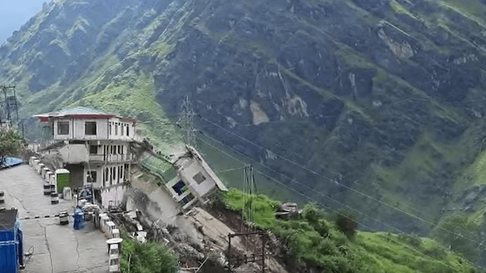
- Joshimath, Uttarakhand (India)
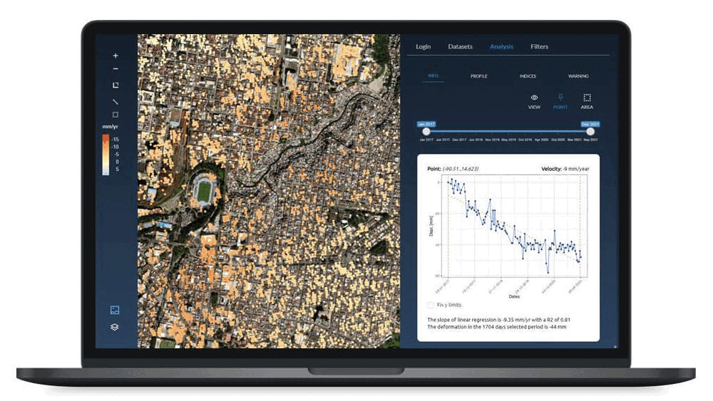
- Sentinel-1
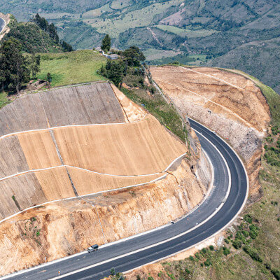
- Landslides
Joshimath (Uttarakhand, India) faces a serious process of land subsidence exacerbated by heavy rains, infrastructure development, and landslides. This phenomenon has caused building collapses, representing a critical threat to its more than 20,000 inhabitants. Analysis conducted with DinSAR satellite technology has enabled the identification of these risks, improving available information and facilitating the generation of early warning systems.
In December 2022, the collapse of buildings and significant cracks in Joshimath, due to accelerated land subsidence, posed a critical threat to the 20,000 residents. Analysis through satellite imagery revealed a sinking process at a rate of 100 mm per year since 2017, with more severe episodes in April and November 2022, and a marked additional sinking of 5.4 cm in just 12 days at the end of 2022. Challenges include river erosion, unplanned development, and mega infrastructure projects.
The use of InSAR technology to monitor land subsidence has been vital, allowing for the development of early warning systems and the assessment of soil stability. Integrating these technologies into infrastructure management offers the opportunity to revolutionise the decision-making process, given the growing number of areas requiring monitoring. This makes the use of satellite data and remote sensing techniques essential for efficient and comprehensive monitoring solutions.
We use InSAR satellite data to continuously monitor deformation and land subsidence as the occurred in Joshimath. We may help you monitoring:


If you are interested in this issue, we suggest you to read an article published in our blog: https://detektia.com/en/landslides-joshimath-india/.