- January 2005 - June 2005
- Madrid (Spain)
- Ascending
- Envisat
- Buildings
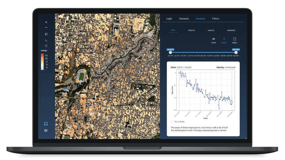
During the 2005 expansion works of the metro station at Puerta del Sol, Detektia applied InSAR technology to monitor potential displacements in nearby buildings. Based on satellite image analysis, structural health indices were calculated to assess the stability of each structure. The results showed no significant deformations or structural damage, confirming the effectiveness of the reinforcement measures implemented prior to construction. This study demonstrated the usefulness of InSAR as a non-invasive monitoring tool.
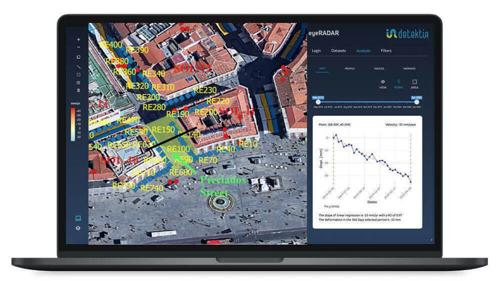
Puerta del Sol, located in the heart of Madrid, was the site of major underground works in 2005: the expansion of the Sol metro (and commuter rail) station, including the construction of a new tunnel beneath Preciados Street.
These works, carried out between January and June 2005, were part of the project to build the modern Sol intermodal station, intended to connect with the new commuter rail line between Atocha and Chamartín.
Given the high density of historic buildings in the area and the intense pedestrian traffic, numerous precautions were taken before and during excavation: foundation reinforcement (micropiles, injections) and rigorous topographic monitoring. The goal was to avoid repeating the kind of damage seen in similar past projects and to ensure that the construction did not compromise the integrity of the iconic buildings surrounding the square.
Years after the works were completed, researchers who are now part of the Detektia team analyzed how satellite-based InSAR technology could complement traditional monitoring to provide a global view of ground and structural behavior. The idea was to assess whether this non-intrusive satellite technology could have detected any differential movements in buildings adjacent to the new station during the critical months of excavation.
This study was published in 2020 in the International Journal of Digital Earth, shortly after Detektia was founded. Much of today’s team contributed to the research, which is especially important to us as it marked the beginning of a key line of investigation: the development of structural health indices.
The Sol area, with its narrow streets and multi-story historic buildings, represents a challenging scenario for InSAR due to the potentially limited number of coherent scatterers (e.g., rooftops with equipment, heavy traffic, etc.). Nevertheless, the precedent set by the InSAR analysis of the Atocha tunneling works and other cases showed that, with proper processing, valuable information could be extracted even in this complex urban environment.
The challenge of using InSAR in Madrid’s historic city center
To carry out this study, ascending-geometry Envisat images were used. It is important to note that in 2005, the resolution and acquisition frequency of SAR imagery were low—in short, the data quality was far below what is available today.
Despite Envisat’s limited spatial and temporal resolution, a sufficiently dense coverage of measurement points was achieved, and the results were satisfactory.
A total of 26 SAR images were processed, covering the entire period of underground works in Sol (first half of 2005).
Using advanced multitemporal InSAR techniques, deformation measurements were obtained for the buildings located above and around the tunnel constructed beneath Preciados Street and Puerta del Sol square. Displacement time series were derived for each point, allowing the monitoring of settlement evolution throughout the different construction phases (tunnel excavation, station cavity enlargement, etc.).
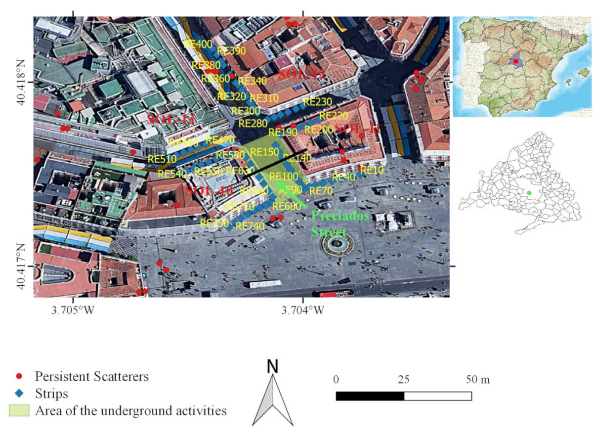
During the analysis, special emphasis was placed on applying the structural health indices proposed in the study to each building in the area. In particular, the main index Ia (aggregated impact index) and the differential deformation index Idiff were calculated for each structure before, during, and after construction.
The structural health indices condensed the deformation state of each building into just a few values, making it easier to compare which buildings were most affected and at what time.
Using the proposed indices, a building showing no signs of disturbance would maintain a low and stable Ia over time, while one starting to experience differential settlement would show a noticeable increase in its indices—indicating potential early damage. This approach allows for satellite-based monitoring of the structural response of dozens of buildings in Sol with each new satellite image.
During the construction works, critical buildings (e.g., listed façades) were equipped with survey targets and crack meters to detect any movement. These data were used to cross-validate the InSAR estimates.
This study shows that combining traditional instrumentation with InSAR data provides a highly comprehensive view: in-situ measurements deliver very local data from specific points, while InSAR offers a continuous deformation map of the entire urban environment.
Results Obtained
The Ia indices calculated for all buildings remained at low values during and after excavation, indicating minimal widespread structural impact.
In terms of raw data, most buildings experienced vertical settlements of less than 2–3 millimeters (within the measurement noise), with no clear patterns of differential deformation among their points. In other words, there was no evidence of tilting or cracking attributable to the construction of the new tunnel.
Buildings located closest to the tunnel alignment—such as those directly above the new gallery under Calle Preciados—showed very slight local movements during the excavation phase, but quickly regained stability. This behavior suggests that the pre-stressing and ground improvement measures implemented before construction fulfilled their purpose.
The virtually negligible deformation observed confirms the effectiveness of the reinforcement measures applied prior to excavation, such as retaining walls and resin injections beneath foundations. InSAR data confirmed that the ground responded in a controlled manner: any initial minor subsidence was halted thanks to preventive containment and consolidation efforts.
The study revealed several key findings:
-
Minimal structural impact: None of the monitored buildings exceeded alert thresholds; all structural health indices remained in the “no impact” category.
-
Maximum localized settlement: The largest recorded displacement was ~3 mm of downward movement in one specific building above the tunnel—so small that it was not even detected by traditional measurement devices.
-
No appreciable differential deformation: No concerning settlement gradients were identified within the structures (Idiff values were near zero for most buildings). As a result, no flexural cracks or structural damage related to the project are expected.
-
Cross-validation: Manual leveling benchmarks and structural monitoring targets installed on key buildings showed no movement, consistent with InSAR readings—providing additional confidence in the satellite data.
Conclusions
The scientific study demonstrated the value of InSAR monitoring in a highly sensitive and crowded urban environment. The main lessons and benefits from this project include:
-
Confirmation of the effectiveness of preventive measures: Integrating InSAR allows for independent verification that foundation reinforcement and settlement control techniques applied before and during construction were effective. By detecting virtually no impact on nearby buildings, the correct execution of those measures was validated—something difficult to ensure based on visual inspection alone.
-
Comprehensive, non-disruptive monitoring: Satellite radar enabled continuous surveillance of the entire construction area without affecting daily activity (the square never had to be closed for monitoring). InSAR can complement on-site inspections in tourist or central locations where installing dense instrumentation is impractical.
-
Stakeholder communication: The deformation maps generated can help reassure business owners, residents, and heritage authorities by visually confirming building stability. This transparency is an added value of the technique.
-
Development of predictive indices: Although no damage was detected in Sol, the analysis helped refine the structural health index methodology in a real-world case. It was confirmed that the indices behaved as expected (remaining low in the absence of impact), laying a solid foundation for their use in future urban projects as early warning indicators.
The expansion of Puerta del Sol Station passed the test without causing harm to neighboring structures. This scientific study demonstrates that InSAR can play a key role in this type of project. Even when the impact is minimal, having an independent and exhaustive monitoring system is invaluable for ensuring safety.
You can find more details about this project in the following scientific article published in 2020:
https://www.tandfonline.com/doi/full/10.1080/17538947.2020.1815878.
Discover the full potential of EyeRADAR