Tracking Deformations that Lead to Sinkhole Formation
- Anticipate terrain failure with high-precision deformation monitoring
- Across large areas
- No instrumentation or on-site installation required
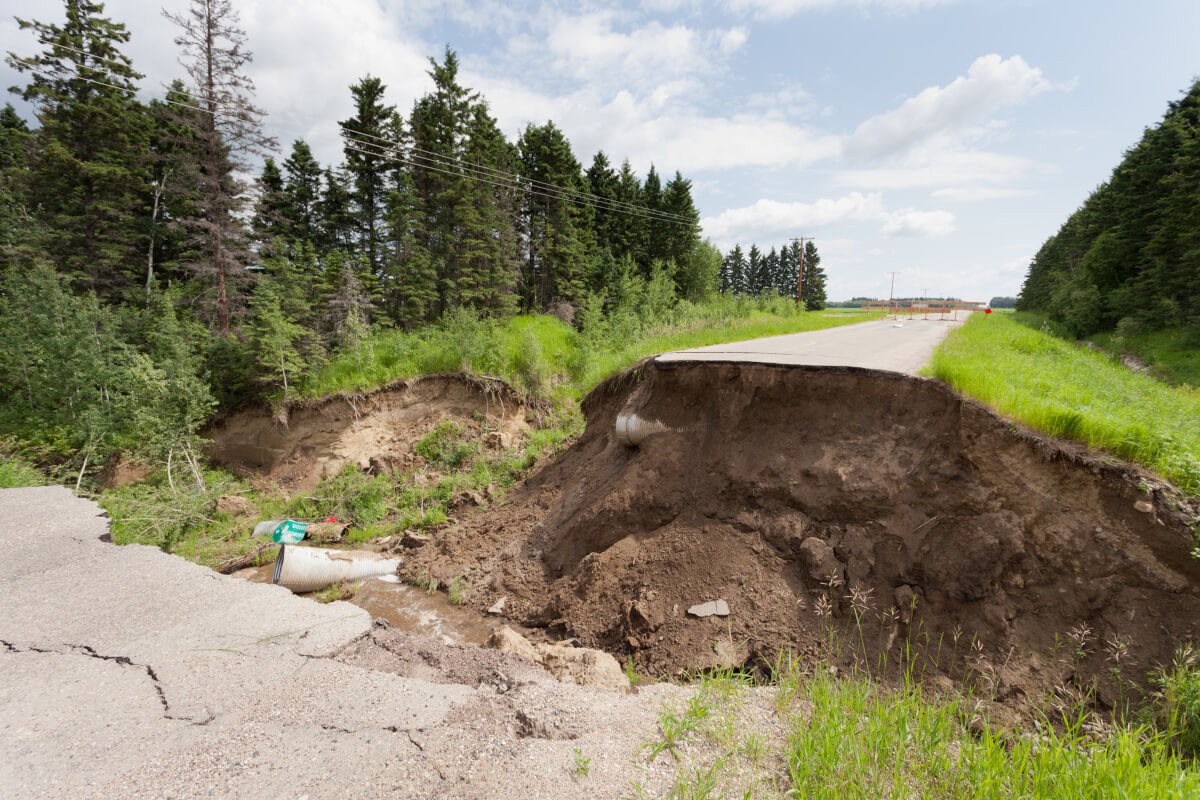
A sinkhole is a depression or sudden collapse of the ground caused by the weakening of the subsurface. This phenomenon can result from processes such as soil erosion, water infiltration that dissolves or carries away underground materials, or human activities like mining. Sinkholes can appear rapidly, causing damage to infrastructure and posing significant risks to human safety.
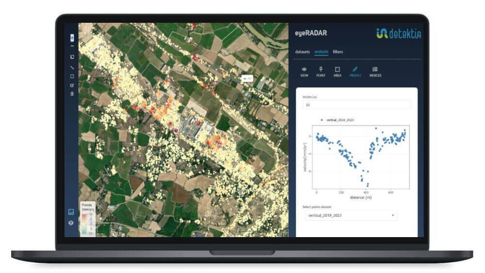
InSAR technology, when combined with precipitation, geological, and topographic data, is a key tool for early identification and prevention of sinkholes. Its ability to detect subtle ground deformations across large areas allows for effective monitoring of vulnerable zones. This enables the implementation of preventive measures and reduces the risk of infrastructure damage and loss of life.
Our clients
The vast amount of SAR data available to us presents a major opportunity to monitor large urban areas located in environments prone to sinkholes, ground collapses, or subsidence.
We must seize this opportunity to effectively monitor and prevent these potentially catastrophic events.

Candela Sancho
CEO de Detektia
Need more info? Let’s talk
More information
What does ground monitoring to prevent sinkhole formation involve?
Ground deformation monitoring allows for the detection and prediction of potential sinkhole formation, with the primary goal of ensuring the safety of people who may be located near the affected area.
Moreover, estimating the likelihood of ground collapse enables the implementation of preventive measures to avoid or minimize potential damage.
Solutions for Predicting New Sinkholes Based on InSAR Technology
Detektia uses InSAR technology to monitor large land areas and detect early ground deformations that could lead to the formation of sinkholes.
InSAR data can be crucial for understanding ground dynamics related to sinkhole formation. For instance, it enables the determination of the extent of movement in a specific area, identification of whether it is a localized or widespread phenomenon, analysis of how displacement magnitude is distributed across the affected zone, and assessment of whether ground acceleration is occurring — potentially indicating a precursor to terrain failure or collapse.
The Importance of Ground Monitoring to Prevent the Formation of New Sinkholes
Understanding the historical behavior of an area is essential for anticipating and preventing future events that have occurred in the past. If we want to analyze the past behavior of a non-instrumented area, satellite InSAR technology is the only alternative.
This information provides great value for the design, construction, and operation of buildings and infrastructure in areas with complex geology.
A New Paradigm in Sinkhole Monitoring
A few years ago, it was unimaginable to have historical information about ground behavior. One of the great advantages of InSAR technology is its ability to analyze the past behavior of an area without the need for prior instrumentation, providing accurate data on the evolution of ground movement.
Thanks to InSAR, both spatial and temporal resolution are improved, significantly extending the analysis period. This technology enables a double-check by comparing data with in-situ sensors, allowing for a more precise and comprehensive diagnosis of ground conditions.