- 2010 - 2025
- British Columbia, Canada
- Sentinel-1 & RADARSAT
- Landslides
In this study, we analyze the landslides that have occurred in British Columbia, the westernmost province of Canada. From 2010 to the present, this region of the American continent has experienced large-scale landslides, resulting in loss of life and millions in material damage. We also examine how satellite InSAR technology has been successfully used to detect these events early, enabling timely response and the prevention of greater damage.
Landslides remain the leading cause of disasters in British Columbia, impacting transportation, trade, and ecosystems. In response to this challenge, InSAR technology not only reduces risk by enabling early detection of these events, but also optimizes investment by lowering repair costs.
At Detektia, we apply satellite-based InSAR technology to continuously detect and monitor landslides. By integrating it with early warning systems, it becomes possible to identify potential landslides in advance, such as those recorded in recent years in Canada. At Detektia, we contribute to the control and monitoring of:
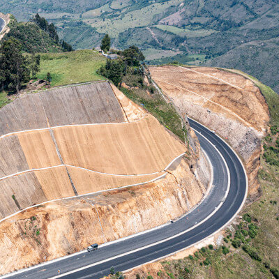


Why Do Landslides Recur in British Columbia? Geographic and Environmental Factors
From 1950 to the present, more than 120 landslides have been recorded, some of them resulting in fatalities. The recurrence of these events is due to a combination of both natural and human-related factors.
On one hand, the region is mountainous. The geography of this area is prone to landslides, snow avalanches, and other natural hazards. In fact, the most affected areas are located in mountainous and glacial regions. According to risk maps developed by BGC Engineering, the most vulnerable and dangerous zones include Mount Meager, characterized by unstable slopes and high water pressure, and the rapidly deglaciating West Greenville Glacier area.
On the other hand, certain forestry practices indirectly contribute to the occurrence of landslides. Clear-cutting on steep slopes reduces the soil’s ability to absorb water, increasing runoff and slope instability. This, combined with the fact that recent wildfires have left areas with reduced vegetation cover, further raises the likelihood of landslides.
Finally, climate change-related events are worsening the situation. Extreme weather events—such as heavy rainfall associated with atmospheric rivers—have become more frequent and intense, exacerbating the risk of landslides.
Areas Most Affected by Recent Landslides
Between 2010 and 2023, several large-scale landslides have occurred.
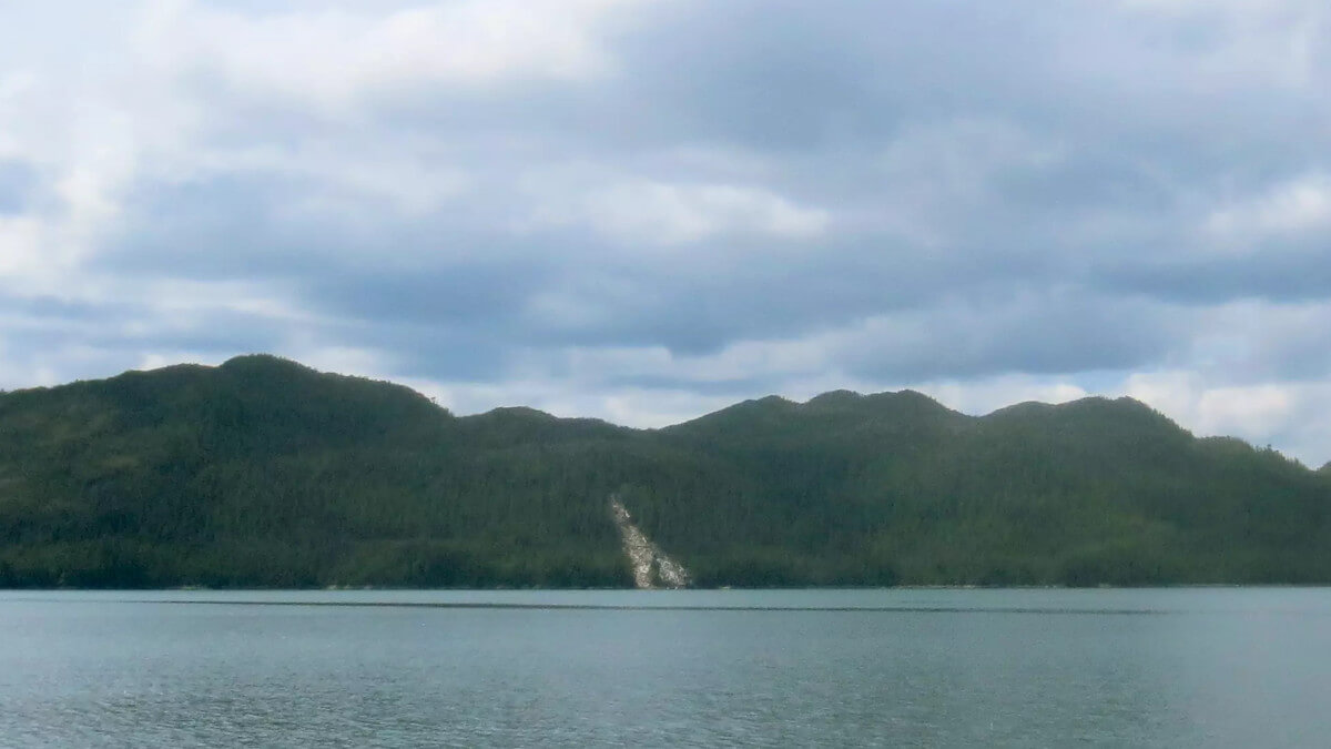
One of the most significant took place on August 6, 2010, when the southern peak of Mount Meager collapsed. This event triggered a debris flow of 48.5 million m³, causing an estimated 10 million Canadian dollars in damage.
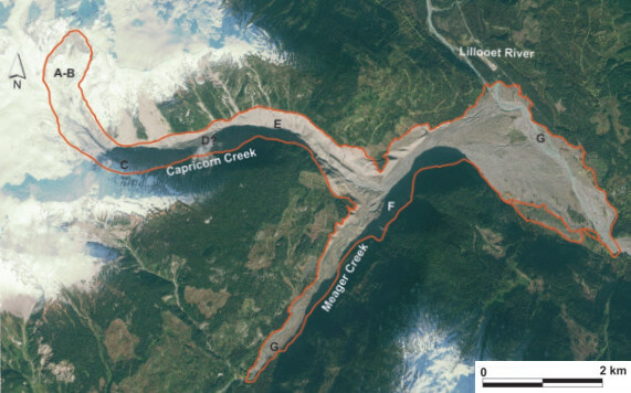
This landslide is considered the largest recorded in Canada’s recent history. It temporarily blocked the flow of Meager Creek, forming a natural dam. The dam was quickly eroded and collapsed, triggering major flooding.
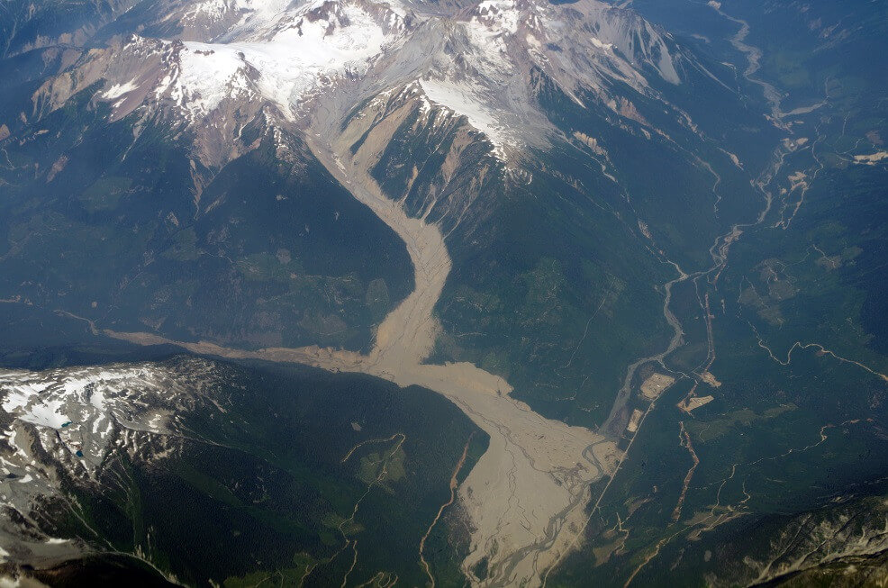
Photo: Tim Gage, CC BY-SA 2.0 https://creativecommons.org/licenses/by-sa/2.0, via Wikimedia Commons:
https://commons.wikimedia.org/wiki/File:2010_Mount_Meager_landslide.jpg
There were no fatalities, partly due to the remoteness of the area and the swift evacuation of workers from a nearby construction site. However, roads, infrastructure, and construction equipment were destroyed.
Another significant case occurred on November 28, 2020, near the West Grenville Glacier. This massive landslide displaced a large volume of water, resulting in a tsunami over 100 meters high. It also caused the erosion of a 10 km-long channel and the loss of essential salmon habitat.
“The landslide displaced enough water to cause a tsunami with a wave height exceeding 100 meters. This drained most of the lake, which then rushed down a 10-kilometer-long channel, causing widespread erosion and the loss of salmon habitat.“
– Dr. Marten Geertsema, Adjunct Professor in the Ecosystem Science and Management Program at UNBC
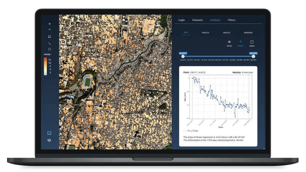
In areas such as Grinder Creek and the Thompson River Valley, ground movements of more than 15 cm per year are being detected.
Use of Satellite InSAR Technology for Early Detection and Prevention
British Columbia is a clear example of the advantages of implementing satellite-based InSAR solutions to anticipate the occurrence of landslides, thereby reducing repair costs and, most importantly, preventing the loss of human lives. This method achieves sub-centimetric precision, making it a key tool for ground monitoring.
For years, two main satellite measurement systems have been used:
- Sentinel-1, which offers a spatial resolution of 2.3 m × 13.9 m and a revisit cycle of 12 days.
- RADARSAT (RCM), with a spatial resolution of 2.7 m × 2.5 m and a revisit cycle of 4 days.
InSAR data processing is carried out automatically using the GAMMA software from NRCan’s EODMS.
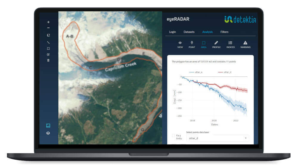
InSAR stands out for its ability to detect subtle ground movements, making it ideal for early risk detection. A prime example of its effectiveness is the Thompson River Valley, where it has been used to monitor slow-moving landslides. The RCM system, with a revisit cycle of just 4 days, has shown excellent results for early identification in this area.
Between October 2017 and June 2021, Sentinel-1 data from the Southern Interior of British Columbia revealed:
- Ground movements of up to 15 cm per year in an east-west direction.
- Ongoing activity in landslide-prone areas such as Grinder Creek, Red Mountain, Yalakom River, and Retaskit Creek.
- Cumulative displacements of approximately 30 cm over four years.
The combination of InSAR data with other geospatial technologies has been key to designing mitigation and climate adaptation measures. Since 2013, Natural Resources Canada (NRCan) and the Geological Survey of Canada (GSC) have employed this technology to monitor high-risk areas, such as strategic railway corridors.
A monitoring system is used that combines multiple satellite technologies. Among the satellites employed are RADARSAT-2 (RS2), SENTINEL-1 (S1) and the RADARSAT Constellation Mission (RCM), which together provide broad and complementary coverage of high-risk areas.
In addition, the TerraSAR-X Staring Spotlight (TSX-ST) system offers a resolution of 0.25 m in azimuth and an 11-day revisit interval, enabling detailed tracking of ground movements. These capabilities are essential for evaluating the effectiveness of early warning alerts.
A notable case is the North Slide landslide, where the system detected a critical movement of approximately 2.5 cm in just 4 days during August and September 2020. This enabled an immediate preventive response, demonstrating the RCM system’s ability to rapidly identify critical ground displacements.
References and Bibliography
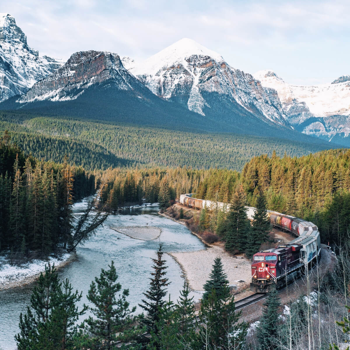
- The photo of Morant’s Curve was downloaded from Freepik: https://www.freepik.es/foto-gratis/curva-morant_10119621.htm
- https://en.wikipedia.org/wiki/2010_Mount_Meager_landslide
- https://link.springer.com/chapter/10.1007/978-3-031-39012-8_19
- https://www.mdpi.com/2072-4292/13/19/3999
- https://www.tandfonline.com/doi/full/10.1080/07038992.2021.1937968